
Konnagar topographic map
Interactive map
Click on the map to display elevation.
About this map
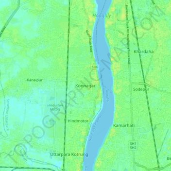
Name: Konnagar topographic map, elevation, terrain.
Average elevation: 6 m
Minimum elevation: -2 m
Maximum elevation: 14 m
Konnagar is located at 22°42′12″N 88°19′07″E / 22.7032°N 88.3185°E / 22.7032; 88.3185. It has an average elevation of 14 metres (45 feet).Konnagar is positioned between Rishra and Hindmotor on the Howrah-Barddhaman Main Line and Grand Trunk Road. It is located on the west bank of the River Hooghly. Approximate area is 4.32 km2.