
Carballo topographic map
Interactive map
Click on the map to display elevation.
About this map
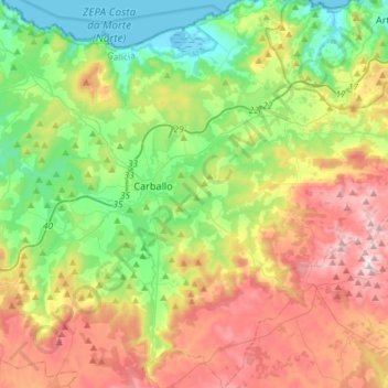
Name: Carballo topographic map, elevation, terrain.
Location: Carballo, Bergantiños, A Coruña, Galicia, Spain (43.10179 -8.77499 43.31530 -8.58257)
Average elevation: 228 m
Minimum elevation: -2 m
Maximum elevation: 590 m