
Dharmasthala topographic map
Interactive map
Click on the map to display elevation.
About this map
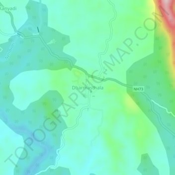
Name: Dharmasthala topographic map, elevation, terrain.
Average elevation: 105 m
Minimum elevation: 44 m
Maximum elevation: 337 m
Other topographic maps
Click on a map to view its topography, its elevation and its terrain.
Belthangadi
India > Karnataka > Beltangadi taluk
Belthangadi, Beltangadi taluk, Dakshina Kannada district, Karnataka, 574214, India
Average elevation: 116 m
Navoor
India > Karnataka > Beltangadi taluk > Kanalu
Navoor, Kanalu, Beltangadi taluk, Dakshina Kannada, Karnataka, 574240, India
Average elevation: 146 m