
Entrance topographic map
Interactive map
Click on the map to display elevation.
About this map
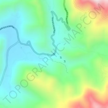
Name: Entrance topographic map, elevation, terrain.
Location: Entrance, Ngân Sơn District, Bac Kan Province, Vietnam (22.38235 105.92721 22.38245 105.92731)
Average elevation: 432 m
Minimum elevation: 261 m
Maximum elevation: 779 m
Other topographic maps
Click on a map to view its topography, its elevation and its terrain.
Ngân Sơn District
Vietnam > Bac Kan Province > Ngân Sơn District
Ngân Sơn District, Bac Kan Province, Vietnam
Average elevation: 588 m
Bắc Kạn
Vietnam > Bac Kan Province > Bắc Kạn
Bắc Kạn, Bac Kan Province, Vietnam
Average elevation: 278 m