
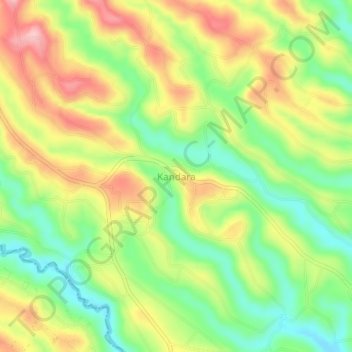
Kandara topographic map
Interactive map
Click on the map to display elevation.
About this map
Name: Kandara topographic map, elevation, terrain.
Location: Kandara, Murang`a, Kenya (-0.91535 36.98074 -0.87535 37.02074)
Average elevation: 1,632 m
Minimum elevation: 1,553 m
Maximum elevation: 1,722 m