
High Top topographic map
Interactive map
Click on the map to display elevation.
About this map
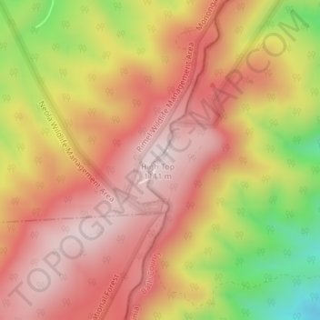
Name: High Top topographic map, elevation, terrain.
Location: High Top, Bath County, Virginia, United States of America (38.06811 -79.96051 38.06821 -79.96041)
Average elevation: 944 m
Minimum elevation: 662 m
Maximum elevation: 1,108 m
Other topographic maps
Click on a map to view its topography, its elevation and its terrain.