
Naga topographic map
Interactive map
Click on the map to display elevation.
About this map
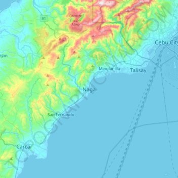
Name: Naga topographic map, elevation, terrain.
Location: Naga, Cebu, Central Visayas, 86017, Philippines (10.04939 123.59677 10.36939 123.91677)
Average elevation: 104 m
Minimum elevation: -2 m
Maximum elevation: 748 m
Other topographic maps
Click on a map to view its topography, its elevation and its terrain.
Pangdan
Philippines > Cebu > Naga > Pangdan
Pangdan, Naga, Cebu, Central Visayas, 86017, Philippines
Average elevation: 139 m