
Lebanan topographic map
Interactive map
Click on the map to display elevation.
About this map
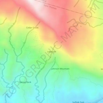
Name: Lebanan topographic map, elevation, terrain.
Location: Lebanan, Rowlandsfield, Saint Thomas, Surrey County, Jamaica (17.95504 -76.33919 17.99504 -76.29919)
Average elevation: 439 m
Minimum elevation: 18 m
Maximum elevation: 1,004 m