
Bérchules topographic map
Interactive map
Click on the map to display elevation.
About this map
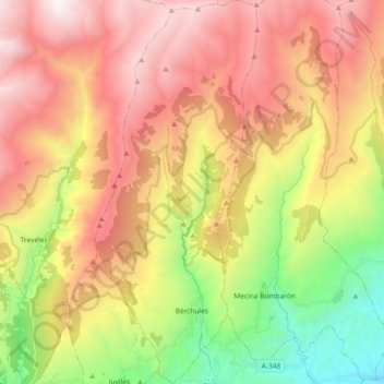
Name: Bérchules topographic map, elevation, terrain.
Average elevation: 1,885 m
Minimum elevation: 661 m
Maximum elevation: 3,080 m
Bérchules is a village and municipality in the central Alpujarra, in the province of Granada in Spain. The origins of the village are Arab. There are two villages in the municipality, Bérchules (36° 58' north and 3° 11' east, elevation 1350 metres), and Alcútar (36° 58' north and 3° 11' east, elevation 1250 metres). The villages are on the road, Órgiva-Trevélez-Ugíjar, and their population is estimated at 900 and 300 respectively.