
Marlow topographic map
Interactive map
Click on the map to display elevation.
About this map
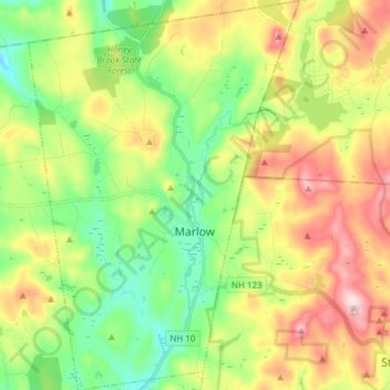
Name: Marlow topographic map, elevation, terrain.
Average elevation: 446 m
Minimum elevation: 311 m
Maximum elevation: 648 m
According to the United States Census Bureau, the town has a total area of 26.4 square miles (68 km2), of which 26.0 sq mi (67 km2) is land and 0.5 sq mi (1.3 km2) is water, comprising 1.78% of the town. Marlow is drained by the Ashuelot River. The town's highest point is in its northeast corner, at the summit of Huntley Mountain, where the elevation reaches 1,978 feet (603 m) above sea level.