
Rudzātu pagasts topographic map
Interactive map
Click on the map to display elevation.
About this map
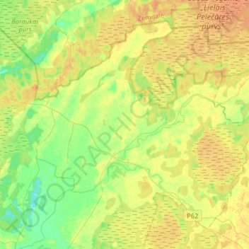
Name: Rudzātu pagasts topographic map, elevation, terrain.
Location: Rudzātu pagasts, Līvānu novads, Latgale, Latvia (56.37724 26.33516 56.49778 26.59602)
Average elevation: 102 m
Minimum elevation: 87 m
Maximum elevation: 115 m