
El Mukkatam topographic map
Interactive map
Click on the map to display elevation.
About this map
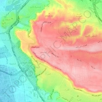
Name: El Mukkatam topographic map, elevation, terrain.
Average elevation: 125 m
Minimum elevation: 28 m
Maximum elevation: 214 m
Other topographic maps
Click on a map to view its topography, its elevation and its terrain.
Abd el Moniem Riad Square
Egypt > Cairo > Abd el Moniem Riad Square
Abd el Moniem Riad Square, Cairo, 12344, Egypt
Average elevation: 27 m
Jabal al Muqattam
Egypt > Cairo Governorate > Cairo
Jabal al Muqattam, Cairo, 11699, Egypt
Average elevation: 125 m