
Batiki topographic map
Interactive map
Click on the map to display elevation.
About this map
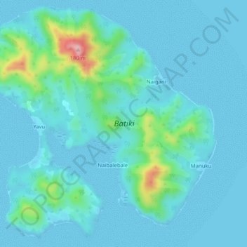
Name: Batiki topographic map, elevation, terrain.
Location: Batiki, Eastern, Fiji (-17.80425 179.13697 -17.76875 179.17610)
Average elevation: 24 m
Minimum elevation: -1 m
Maximum elevation: 186 m
Other topographic maps
Click on a map to view its topography, its elevation and its terrain.