
Bourne Copse topographic map
Interactive map
Click on the map to display elevation.
About this map
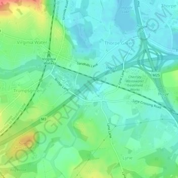
Name: Bourne Copse topographic map, elevation, terrain.
Average elevation: 29 m
Minimum elevation: 12 m
Maximum elevation: 70 m
Other topographic maps
Click on a map to view its topography, its elevation and its terrain.
Thorpe Lea
United Kingdom > England > Runnymede
Thorpe Lea, Runnymede, Surrey, South East, England, TW20 8JX, United Kingdom
Average elevation: 16 m