
Castlemaine topographic map
Interactive map
Click on the map to display elevation.
About this map
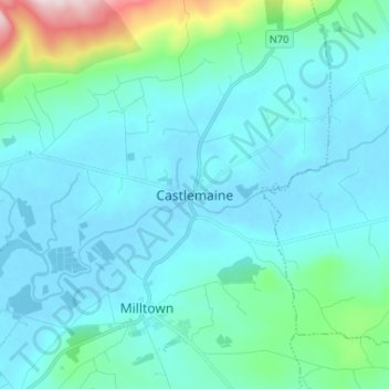
Name: Castlemaine topographic map, elevation, terrain.
Location: Castlemaine, County Kerry, Munster, Ireland (52.12857 -9.74118 52.20857 -9.66118)
Average elevation: 60 m
Minimum elevation: -2 m
Maximum elevation: 478 m