
Londerzeel topographic map
Interactive map
Click on the map to display elevation.
About this map
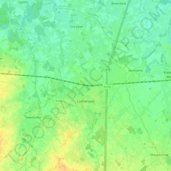
Name: Londerzeel topographic map, elevation, terrain.
Location: Londerzeel, Flemish Brabant, Flanders, 1840, Belgium (50.97391 4.22124 51.04319 4.33345)
Average elevation: 11 m
Minimum elevation: 0 m
Maximum elevation: 25 m
Other topographic maps
Click on a map to view its topography, its elevation and its terrain.
Londerzeel
Belgium > Flanders > Londerzeel
Londerzeel, Halle-Vilvoorde, Flemish Brabant, Flanders, 1840, Belgium
Average elevation: 10 m