
Halvad topographic map
Interactive map
Click on the map to display elevation.
About this map
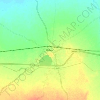
Name: Halvad topographic map, elevation, terrain.
Location: Halvad, Halvad Taluka, Morbi District, Gujarat, 363330, India (22.97597 71.13970 23.05597 71.21970)
Average elevation: 43 m
Minimum elevation: 25 m
Maximum elevation: 64 m
Halvad is located at 23°01′N 71°11′E / 23.02°N 71.18°E / 23.02; 71.18. It has an average elevation of 46 metres (150 feet). Halvad sits on the banks of the Samatsar Pond.