Geolocate

Loonar topographic map

Interactive map

Click on the map to display elevation.

About this map

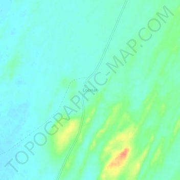
Name: Loonar topographic map, elevation, terrain.

Location: Loonar, Jaisalmer Tehsil, Jaisalmer District, Rajasthan, India (26.57597 70.24712 26.61597 70.28712)

Average elevation: 119 m

Minimum elevation: 107 m

Maximum elevation: 154 m

Other topographic maps

Click on a map to view its topography, its elevation and its terrain.

Tanot

India > Rajasthan > Jaisalmer Tehsil

Tanot, Jaisalmer Tehsil, Jaisalmer District, Rajasthan, India

Average elevation: 107 m

Thar Desert

India > Rajasthan > Jaisalmer Tehsil

Thar Desert, Jaisalmer Tehsil, Jaisalmer District, Rajasthan, India

Average elevation: 88 m

Longewala

India > Rajasthan > Jaisalmer Tehsil

Longewala, Jaisalmer Tehsil, Jaisalmer District, Rajasthan, India

Average elevation: 106 m

Kanoi

India > Rajasthan > Jaisalmer Tehsil

Kanoi, Jaisalmer Tehsil, Jaisalmer District, Rajasthan, India

Average elevation: 203 m

Lodurva

India > Rajasthan > Jaisalmer Tehsil > Lodurva

Lodurva, Jaisalmer Tehsil, Jaisalmer, Rajasthan, India

Average elevation: 173 m