
Othello topographic map
Interactive map
Click on the map to display elevation.
About this map
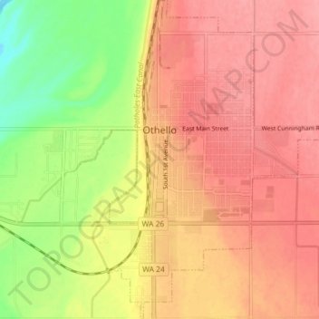
Name: Othello topographic map, elevation, terrain.
Location: Othello, Adams County, Washington, United States (46.79676 -119.18664 46.84593 -119.12736)
Average elevation: 313 m
Minimum elevation: 256 m
Maximum elevation: 346 m
Other topographic maps
Click on a map to view its topography, its elevation and its terrain.