
Bryn Mawr-Skyway topographic map
Click on the map to display elevation.
Gear up for your next adventure:
As an Amazon Associate, this site earns from qualifying purchases at no extra cost to you.
About this map
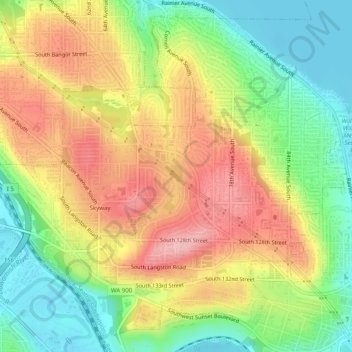
Name: Bryn Mawr-Skyway topographic map, elevation, terrain.
Average elevation: 70 m
Minimum elevation: 0 m
Maximum elevation: 146 m
Other topographic maps
Click on a map to view its topography, its elevation and its terrain.
Snoqualmie Falls
United States of America > Washington > Bellevue > Snoqualmie Falls
Average elevation: 187 m