Geolocate

Bryn Mawr-Skyway topographic map

Interactive map

Click on the map to display elevation.

About this map

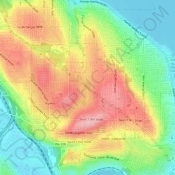
Name: Bryn Mawr-Skyway topographic map, elevation, terrain.

Location: Bryn Mawr-Skyway, King County, Washington, 98178, United States of America (47.47925 -122.26853 47.50973 -122.21885)

Average elevation: 70 m

Minimum elevation: 0 m

Maximum elevation: 146 m

Other topographic maps

Click on a map to view its topography, its elevation and its terrain.

Conway

United States of America > Washington > Conway

Average elevation: 7 m

Bow

United States of America > Washington > Bow

Average elevation: 29 m

Helen

United States of America > Washington > Helen

Average elevation: 157 m

Mount Venus

United States of America > Washington

Average elevation: 1,476 m

Holly

United States of America > Washington > Holly

Average elevation: 59 m

Tamill

United States of America > Washington > Seattle > Tamill

Average elevation: 42 m

Narada Falls

United States of America > Washington

Average elevation: 1,444 m