
Olney topographic map
Interactive map
Click on the map to display elevation.
About this map
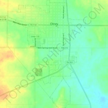
Name: Olney topographic map, elevation, terrain.
Location: Olney, Young County, Texas, United States (33.34046 -98.77693 33.37977 -98.74298)
Average elevation: 366 m
Minimum elevation: 351 m
Maximum elevation: 384 m
Other topographic maps
Click on a map to view its topography, its elevation and its terrain.
Olney
United States > Texas > Young County > Olney > Olney
Olney, Young County, Texas, 76374, United States
Average elevation: 372 m