
Crew topographic map
Interactive map
Click on the map to display elevation.
About this map
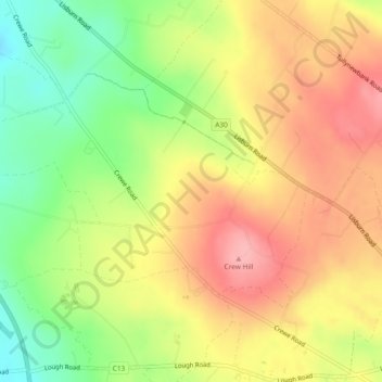
Name: Crew topographic map, elevation, terrain.
Location: Crew, Lisburn, County Antrim, Northern Ireland, United Kingdom (54.56363 -6.20799 54.58024 -6.16538)
Average elevation: 140 m
Minimum elevation: 80 m
Maximum elevation: 190 m
Northern Ireland trails, hiking, mountain biking, running and outdoor activities
Other topographic maps
Click on a map to view its topography, its elevation and its terrain.