
Vlodrop topographic map
Interactive map
Click on the map to display elevation.
About this map
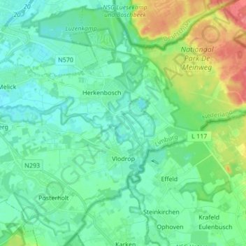
Name: Vlodrop topographic map, elevation, terrain.
Location: Vlodrop, Roerdalen, Limburg, Netherlands, The Netherlands (51.11795 6.03987 51.17049 6.17542)
Average elevation: 43 m
Minimum elevation: 23 m
Maximum elevation: 94 m