
Punta de Treserols / Monte Perdido topographic map
Interactive map
Click on the map to display elevation.
About this map
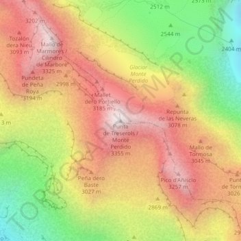
Name: Punta de Treserols / Monte Perdido topographic map, elevation, terrain.
Average elevation: 2,806 m
Minimum elevation: 2,152 m
Maximum elevation: 3,341 m