
Xing'an County topographic map
Interactive map
Click on the map to display elevation.
About this map
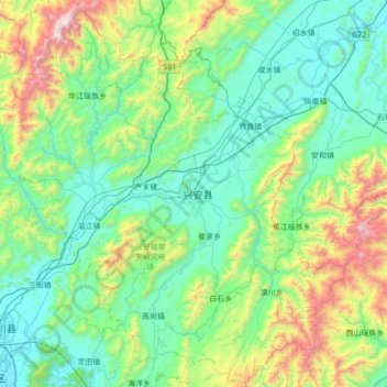
Name: Xing'an County topographic map, elevation, terrain.
Location: Xing'an County, Guilin, Guangxi, China (25.31020 110.23752 25.91704 110.93081)
Average elevation: 547 m
Minimum elevation: 147 m
Maximum elevation: 2,093 m
Other topographic maps
Click on a map to view its topography, its elevation and its terrain.