
Innenstadt topographic map
Interactive map
Click on the map to display elevation.
About this map
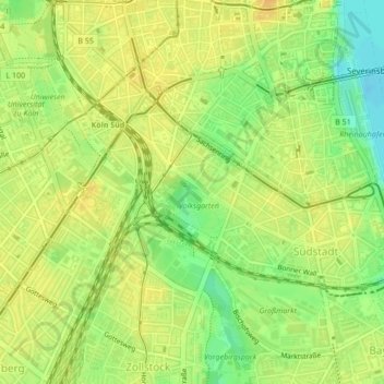
Name: Innenstadt topographic map, elevation, terrain.
Location: Innenstadt, Cologne, Höningen, North Rhine-Westphalia, Germany (50.92204 6.94661 50.92220 6.94684)
Average elevation: 54 m
Minimum elevation: 36 m
Maximum elevation: 63 m
Other topographic maps
Click on a map to view its topography, its elevation and its terrain.
Rodenkirchen
Germany > North Rhine-Westphalia > Cologne > Höningen
Rodenkirchen, Höningen, Cologne, North Rhine-Westphalia, 50997, Germany
Average elevation: 54 m