
Irvine topographic map
Interactive map
Click on the map to display elevation.
About this map
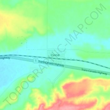
Name: Irvine topographic map, elevation, terrain.
Location: Irvine, Cypress County, Alberta, Canada (49.93844 -110.29326 49.97844 -110.25326)
Average elevation: 781 m
Minimum elevation: 753 m
Maximum elevation: 845 m
Irvine is a hamlet in Alberta, Canada within Cypress County. It is located approximately 35 kilometres (22 mi) east of Medicine Hat on Highway 1 and has an elevation of 763 metres (2,503 ft). The hamlet is located in census division No. 1 and in the federal riding of Medicine Hat.