
Chislet topographic map
Interactive map
Click on the map to display elevation.
About this map
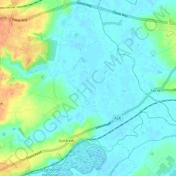
Name: Chislet topographic map, elevation, terrain.
Location: Chislet, Canterbury, Kent, South East, England, United Kingdom (51.31401 1.16594 51.36503 1.25007)
Average elevation: 10 m
Minimum elevation: -1 m
Maximum elevation: 38 m
England trails, hiking, mountain biking, running and outdoor activities
Other topographic maps
Click on a map to view its topography, its elevation and its terrain.