
Washir topographic map
Interactive map
Click on the map to display elevation.
About this map
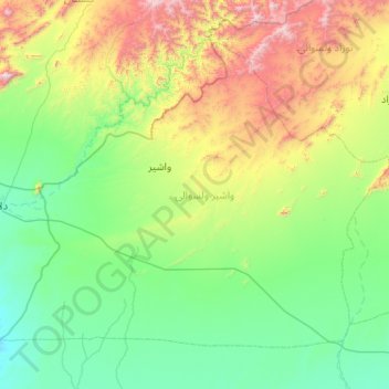
Name: Washir topographic map, elevation, terrain.
Location: Washir, Helmand, Afghanistan (31.84456 63.43441 32.52801 64.46258)
Average elevation: 1,191 m
Minimum elevation: 762 m
Maximum elevation: 2,710 m
Other topographic maps
Click on a map to view its topography, its elevation and its terrain.
Lashkar Gah
Afghanistan > Helmand > Lashkar Gah
Lashkar Gah, Lashkargah, Helmand, Afghanistan
Average elevation: 804 m