
Amieira topographic map
Interactive map
Click on the map to display elevation.
About this map
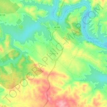
Name: Amieira topographic map, elevation, terrain.
Location: Amieira, Amieira e Alqueva, Portel, Alentejo Region, Portugal (38.26440 -7.57763 38.30440 -7.53763)
Average elevation: 174 m
Minimum elevation: 114 m
Maximum elevation: 256 m