
Bahati topographic map
Interactive map
Click on the map to display elevation.
About this map
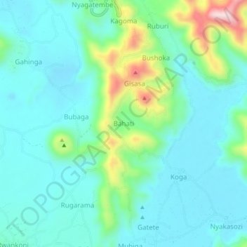
Name: Bahati topographic map, elevation, terrain.
Location: Bahati, Chahafi, Kisoro, Western Region, Uganda (-1.32000 29.74667 -1.28000 29.78667)
Average elevation: 1,963 m
Minimum elevation: 1,890 m
Maximum elevation: 2,226 m