
Engineer topographic map
Interactive map
Click on the map to display elevation.
About this map
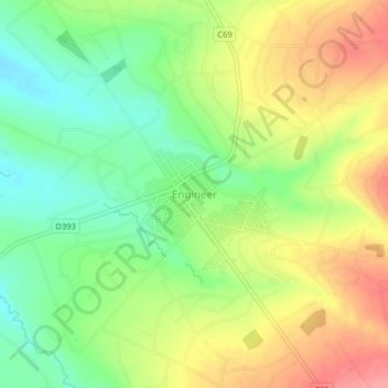
Name: Engineer topographic map, elevation, terrain.
Location: Engineer, Nyandarua, Kenya (-0.62539 36.55769 -0.58539 36.59769)
Average elevation: 2,481 m
Minimum elevation: 2,440 m
Maximum elevation: 2,529 m