
Pakondo topographic map
Interactive map
Click on the map to display elevation.
About this map
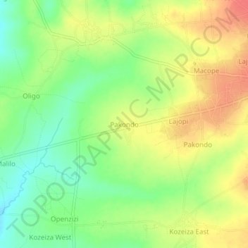
Name: Pakondo topographic map, elevation, terrain.
Location: Pakondo, Adjumani, Northern Region, Uganda (3.34982 31.73693 3.38982 31.77693)
Average elevation: 796 m
Minimum elevation: 766 m
Maximum elevation: 826 m