
Thank you for supporting this site ❤️
Make a donation
Make a donation
Gear up for your next adventure:
As an Amazon Associate, this site earns from qualifying purchases at no extra cost to you.
Tamaladagi topographic map
Click on the map to display elevation.
Thank you for supporting this site ❤️
Make a donation
Make a donation
Gear up for your next adventure:
As an Amazon Associate, this site earns from qualifying purchases at no extra cost to you.
About this map
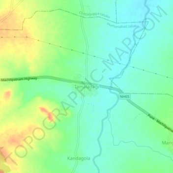
Name: Tamaladagi topographic map, elevation, terrain.
Location: Tamaladagi, Humanabad taluku, Bidar district, Karnataka, India (17.74332 77.26135 17.78332 77.30135)
Average elevation: 598 m
Minimum elevation: 582 m
Maximum elevation: 624 m
Thank you for supporting this site ❤️
Make a donation
Make a donation
Gear up for your next adventure:
As an Amazon Associate, this site earns from qualifying purchases at no extra cost to you.