
Thank you for supporting this site ❤️
Make a donation
Make a donation
Gear up for your next adventure:
As an Amazon Associate, this site earns from qualifying purchases at no extra cost to you.
Al Bateen topographic map
Click on the map to display elevation.
Thank you for supporting this site ❤️
Make a donation
Make a donation
Gear up for your next adventure:
As an Amazon Associate, this site earns from qualifying purchases at no extra cost to you.
About this map
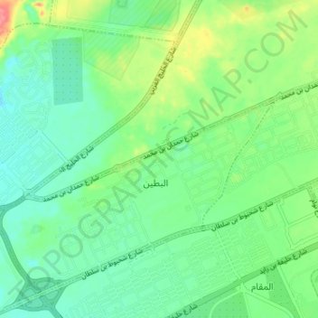
Name: Al Bateen topographic map, elevation, terrain.
Location: Al Bateen, Abu Dhabi Emirate, United Arab Emirates (24.18445 55.58717 24.23397 55.65125)
Average elevation: 238 m
Minimum elevation: 215 m
Maximum elevation: 288 m
Thank you for supporting this site ❤️
Make a donation
Make a donation
Gear up for your next adventure:
As an Amazon Associate, this site earns from qualifying purchases at no extra cost to you.