
Narrows topographic map
Click on the map to display elevation.
About this map
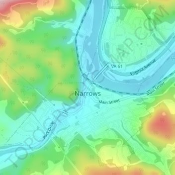
Name: Narrows topographic map, elevation, terrain.
Location: Narrows, Giles County, Virginia, 24214, United States (37.31984 -80.82729 37.34466 -80.79467)
Average elevation: 531 m
Minimum elevation: 459 m
Maximum elevation: 705 m
Other topographic maps
Click on a map to view its topography, its elevation and its terrain.
Eggleston
United States > Virginia > Giles County
It lies at an elevation of 1,821 feet.
Average elevation: 572 m