
Make a donation
Gear up for your next adventure:
As an Amazon Associate, this site earns from qualifying purchases at no extra cost to you.
Kampung Kebun Teh topographic map
Click on the map to display elevation.
Gear up for your next adventure:
As an Amazon Associate, this site earns from qualifying purchases at no extra cost to you.
About this map
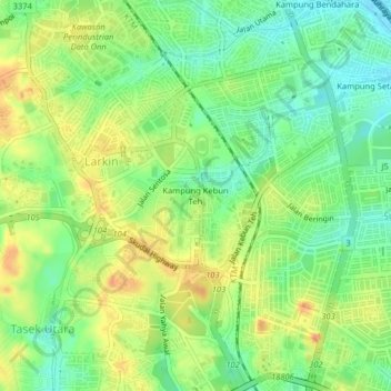
Name: Kampung Kebun Teh topographic map, elevation, terrain.
Location: Kampung Kebun Teh, Johor Bahru, Johor, 80250, Malaysia (1.47236 103.73079 1.51236 103.77079)
Average elevation: 29 m
Minimum elevation: 4 m
Maximum elevation: 60 m
Make a donation
Gear up for your next adventure:
As an Amazon Associate, this site earns from qualifying purchases at no extra cost to you.
Other topographic maps
Click on a map to view its topography, its elevation and its terrain.
Pandan Lake Recreation Site
Malaysia > Johor > Johor Bahru > Kampung Seri Bahagia
Average elevation: 11 m
Make a donation
Gear up for your next adventure:
As an Amazon Associate, this site earns from qualifying purchases at no extra cost to you.