
Burley Gate topographic map
Interactive map
Click on the map to display elevation.
About this map
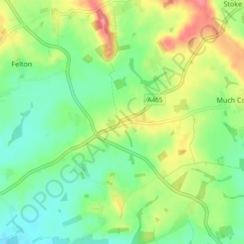
Name: Burley Gate topographic map, elevation, terrain.
Location: Burley Gate, Herefordshire, England, HR1 3QU, United Kingdom (52.10297 -2.60885 52.14297 -2.56885)
Average elevation: 87 m
Minimum elevation: 58 m
Maximum elevation: 134 m
England trails, hiking, mountain biking, running and outdoor activities