
Port of Menteith topographic map
Interactive map
Click on the map to display elevation.
About this map
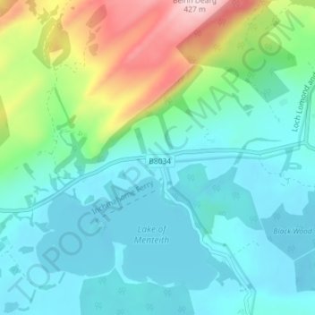
Name: Port of Menteith topographic map, elevation, terrain.
Location: Port of Menteith, Stirling, Scotland, FK8 3RB, United Kingdom (56.16469 -4.30498 56.20469 -4.26498)
Average elevation: 101 m
Minimum elevation: 11 m
Maximum elevation: 399 m
Stirling trails, hiking, mountain biking, running and outdoor activities
Other topographic maps
Click on a map to view its topography, its elevation and its terrain.
Loch Lomond and The Trossachs National Park
United Kingdom > Scotland > Stirling
The park straddles the Highland Boundary Fault, which divides it into two distinct regions - lowland and highland - that differ in underlying geology, soil types and topography. The change in rock type can most clearly be seen at Loch Lomond itself, as the fault runs across the islands of Inchmurrin, Creinch,…
Average elevation: 291 m