
Fyti topographic map
Interactive map
Click on the map to display elevation.
About this map
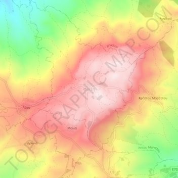
Name: Fyti topographic map, elevation, terrain.
Location: Fyti, Paphos District, Cyprus, 8812, Cyprus (34.90856 32.52499 34.94856 32.56499)
Average elevation: 519 m
Minimum elevation: 241 m
Maximum elevation: 704 m