
Sovata topographic map
Interactive map
Click on the map to display elevation.
About this map
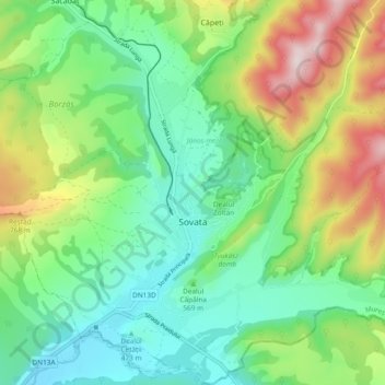
Name: Sovata topographic map, elevation, terrain.
Location: Sovata, Mureș, 545500, Romania (46.56981 25.04376 46.63416 25.10715)
Average elevation: 586 m
Minimum elevation: 416 m
Maximum elevation: 945 m