
Gadsden topographic map
Interactive map
Click on the map to display elevation.
About this map
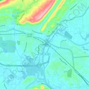
Name: Gadsden topographic map, elevation, terrain.
Location: Gadsden, Etowah County, Alabama, 35901, United States (33.97093 -86.03896 34.05093 -85.95896)
Average elevation: 179 m
Minimum elevation: 150 m
Maximum elevation: 326 m