
Norrtälje kommun topographic map
Interactive map
Click on the map to display elevation.
About this map
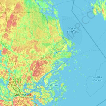
Name: Norrtälje kommun topographic map, elevation, terrain.
Location: Norrtälje kommun, Stockholm County, Sweden (59.20708 18.08522 60.30070 20.00838)
Average elevation: 13 m
Minimum elevation: -7 m
Maximum elevation: 97 m
Other topographic maps
Click on a map to view its topography, its elevation and its terrain.