
Bhagwānpur topographic map
Interactive map
Click on the map to display elevation.
About this map
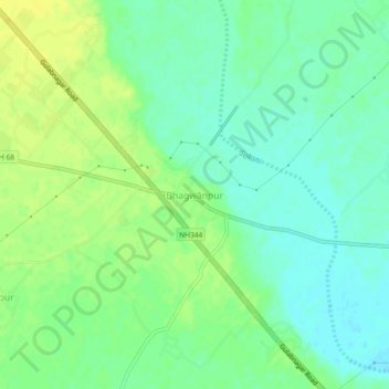
Name: Bhagwānpur topographic map, elevation, terrain.
Location: Bhagwānpur, Roorkee, Haridwar, Uttarakhand, 247661, India (29.92216 77.79377 29.96216 77.83377)
Average elevation: 276 m
Minimum elevation: 266 m
Maximum elevation: 287 m
Other topographic maps
Click on a map to view its topography, its elevation and its terrain.
Manglaur
India > Uttarakhand > Roorkee
Manglaur, Roorkee, Haridwar District, Uttarakhand, 247656, India
Average elevation: 264 m
Haljora
India > Uttarakhand > Roorkee
Haljora, Roorkee, Haridwar District, Uttarakhand, India
Average elevation: 309 m
Roorkee
India > Uttarakhand > Roorkee
Roorkee, Haridwar, Uttarakhand, 247667, India
Average elevation: 270 m
Gurunarsa
India > Uttarakhand > Roorkee
Gurunarsa, Roorkee, Haridwar, Uttarakhand, 247670, India
Average elevation: 260 m