
Klæbu topographic map
Interactive map
Click on the map to display elevation.
About this map
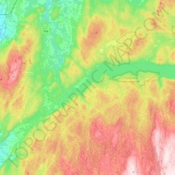
Name: Klæbu topographic map, elevation, terrain.
Location: Klæbu, Trondheim, Trøndelag, Norway (63.15990 10.35636 63.34097 10.72520)
Average elevation: 357 m
Minimum elevation: 34 m
Maximum elevation: 814 m
Other topographic maps
Click on a map to view its topography, its elevation and its terrain.
Jonsvatnet
Jonsvatnet, Bratsbergvegen, Lerkendal, Trondheim, Trøndelag, 7039, Norway
Average elevation: 193 m