
Cáceres topographic map
Interactive map
Click on the map to display elevation.
About this map
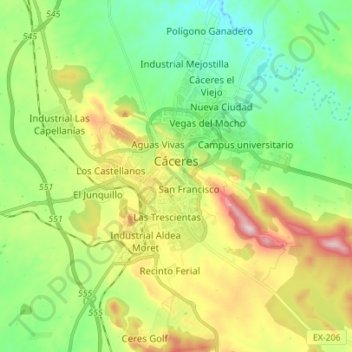
Name: Cáceres topographic map, elevation, terrain.
Location: Cáceres, Extremadura, Spain (39.41613 -6.42919 39.52352 -6.32669)
Average elevation: 415 m
Minimum elevation: 293 m
Maximum elevation: 641 m
Other topographic maps
Click on a map to view its topography, its elevation and its terrain.
Sierra de San Pedro
Spain > Extremadura > Cáceres
Sierra de San Pedro, Cáceres, Extremadura, Spain
Average elevation: 445 m