
Bad Liebenwerda topographic map
Interactive map
Click on the map to display elevation.
About this map
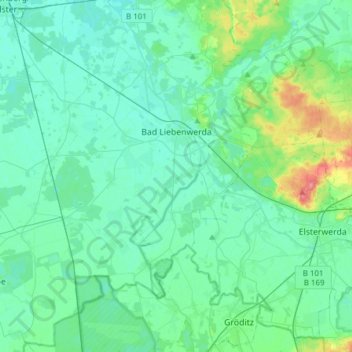
Name: Bad Liebenwerda topographic map, elevation, terrain.
Average elevation: 94 m
Minimum elevation: 82 m
Maximum elevation: 154 m
Other topographic maps
Click on a map to view its topography, its elevation and its terrain.
Finsterwalde
Germany > Brandenburg > Elbe-Elster
Finsterwalde, Elbe-Elster, Brandenburg, 03238, Germany
Average elevation: 113 m