
Mlolongo topographic map
Interactive map
Click on the map to display elevation.
About this map
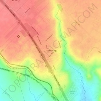
Name: Mlolongo topographic map, elevation, terrain.
Location: Mlolongo, Machakos, East Kenya, Kenya (-1.40336 36.93824 -1.38602 36.95017)
Average elevation: 1,591 m
Minimum elevation: 1,535 m
Maximum elevation: 1,621 m