
Utnur topographic map
Interactive map
Click on the map to display elevation.
About this map
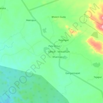
Name: Utnur topographic map, elevation, terrain.
Location: Utnur, Utnur mandal, Adilabad, Telangana, 504311, India (19.32959 78.73367 19.40959 78.81367)
Average elevation: 388 m
Minimum elevation: 328 m
Maximum elevation: 561 m